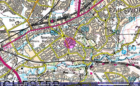
Tetlow Street 3    Tetlow Coat of Arms

Researching Tetlows World-wide


Up ] Stade Thomas Tetlow ] Tetlow ] Tetlow Avenue ] Tetlow Bridge ] Tetlow Brook ] Tetlow Building ] Tetlow Fold 1 ] Tetlow Fold 2 ] Tetlow Fountain ] Tetlow Grove ] Tetlow Lane ] Tetlow Place 1 ] Tetlow Place 2 ] Tetlow Road ] Tetlow Street 1 ] Tetlow Street 2 ] [ Tetlow Street 3 ] Tetlow Street 4 ] Tetlow Street 5 ] Tetlow Street 6 ] Tetlow Street 7 ] Tetlow Terrace ] Tetlow Well ] Tetlow Yard ] Tetlows ]

Tetlow Street, Newton Heath, M40 1WZ

Location

Tetlow Street is in Manchester, off Daisy Bank, near Brookdale Park, Newton Heath. Map co-ordinates are (N53:29:53 W2:10:24). The following Ordnance Survey map shows the locality (the pink circle):

OS Map of Tetlow Street, Newton Heath

Image produced from the Ordnance Survey Get-a-map service. Image reproduced with kind permission of Ordnance Survey and Ordnance Survey of Northern Ireland.

Whilst a more detailed street map can be accessed by following this link (note however that to return to this site you will need to use the back button on your browser). An aerial photograph can also be accessed from this same link.
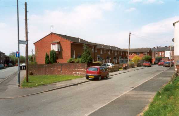
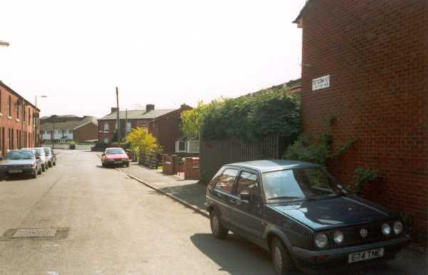
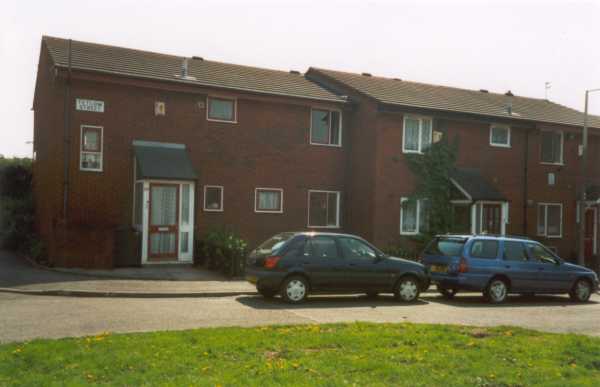
Photos

Tetlow Street, Newton Heath 2001 Tetlow Street, Newton Heath 2001

Tetlow Street is an L-shaped cul-de-sac which runs off Daisy Bank. The photograph above was taken at the entrance to the street, whilst the photo top right is at the other end of the street looking back towards Daisy Bank. On the right is the bottom of the 'L', with the house on the left being fortunate to have two Tetlow Street signs!

Tetlow Street, Newton Heath 2001

Home Up

Date page was last edited: 29 October 2001