|
|
Tetlow BuildingLocationThe following pictures were taken in Stalybridge during the restoration of the Huddersfield Narrow Canal.
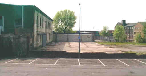
Looking west along the line of the canal from near Melbourne Street bridge. The line of the canal was past the lamp post, to the right of the tree behind it and through the buildings behind that. Part of the Tetlow building behind the lamp post had been demolished, revealing the hidden frontage of a former canal-side warehouse (on the left of the picture). This was going to be retained and incorporated into the restoration, but has now been demolished. The low building in front of the tree and the Sports Centre behind it have been demolished.
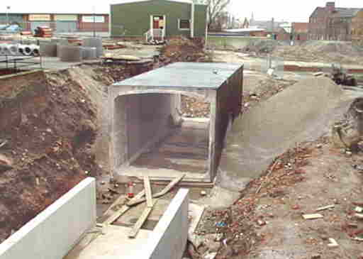
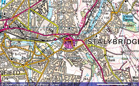
Looking west from Melbourne Street bridge, past the pre-cast sectional box culvert bridge for Back Melbourne Street. (March 12th 2000). The green building above is part of the former Tetlow building. The line of the canal curves to the left behind this building. When the right hand part of the building, which was across the line of the canal, was demolished, the facade of an original canalside warehouse was discovered inside. It had been hoped to retain the facade and re-furbish the building behind it but it has now been demolished. Map co-ordinates are (N53:28:59 W2:03:23). The following Ordnance Survey map shows the locality (the pink circle):
Whilst a more detailed street map can be accessed by following this link (note however that to return to this site you will need to use the back button on your browser).
|
|
Date page was last edited: 11 March 2006 |